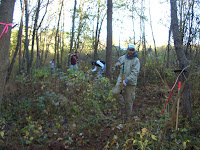
 The Six Mile Run Reservoir Site trail system has seen change and improvement this year thanks to the hard work and dedication provided by volunteers from the Six Mile Run chapter of JORBA (Jersey Off Road Biking Association). Working closely with park staff, the "two Jasons" - volunteer coordinators and co-leaders - reworked, improved and, with the help of many volunteers, blazed approximately twenty miles of multi-use trails at the Six Mile Run site. This is a considerable addition to the former trail network that offered about 6-7 miles of trails for public use.
Regular par
 k users will notice several changes including the discontinuation of the former yellow trail, alterations to the red trail and blue trails and the addition of a new orange trail. The old yellow trail was often inaccessible and/or overly muddy due to its location in the low lying flood plain section of the run. As a result a decision was made to close that portion of the trail network. In addition the former red trail that followed the elevated forested tree line was suffering from erosion while access to the trail head from Canal Road had become a safety issue as traffic has steadily increased in the area over the years. So the red trail was reworked to avoid the eroded section and the new trail head is now located at the parking area on Jacques Lane.
While the Park works to get a new trail map published for public use, JORBA volunteer Rob Blash has produced a map that users can download and print from the organization's site (click on map image below to access that PDF file).

The park staff is pleased with the outcome of this overhaul to the site's trail system and happy to have established such a good working partnership with JORBA. The work and dedication their volunteers have put in at the site has been invaluable! Thanks to their efforts, an extended trail network at Six Mile Run is now open for use to the public.
Click here to learn more about the Six Mile Run trail system.


